What can we learn from the Maya about managing scarce water resources?
The Maya emerged in the Yucatán more than 4 000 years ago, where they prospered for thousands of years until their civilisation’s collapse. The reasons for this collapse have been attributed to several factors. Some scholars such as Curtis, Hodell and Brenner[1] posit that a drought was the principal cause of their downfall.
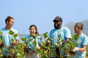
To survive in a region with no surface waters, the ancient Maya had to engage in collective water management. Users took part in establishing the rules of usage and acted as stewards of the resource. The hydraulic system engineered by the Maya was able to adapt to the evolving needs of a growing population in the Yucatán, which quadrupled from about 3 million to 13 million over several hundred years. To deal with seasonal variations in rainfall, the Maya developed strategies for storing and managing water. They learned how to build reservoirs to capture rainfall. They constructed dams on the top of hills, so as to use the slopes to distribute water through canals in a complex irrigation system.
Cities were designed to catch water from rainfall and quarries and excavations were converted into water reservoirs. The Maya built roads (called sacbes) to connect cities and towns and provide access to sacred centres like temples, as well as to water reservoirs and cenotes. The landscape would have been dotted with circular reservoirs known as cenotes, which would have been the main source of freshwater for the population, as they are today.
The word cenote comes from the Mayan word d’zonot (sinkhole). Cenotes form when a large portion of rainfall infiltrates the soil, creating streams and channels that disappear underground. In karstic systems, the rock is porous. Groundwater flows through the porous rock, gradually carving out a cavity filled with water. Over time, this cavity grows to the point where the sinkhole can be tens of metres wide and its sheer walls just as high. The majority of the cenotes, however, are located in the so/called so-called “Ring of Cenotes[2]”, an important and unique feature of the Yucatán Peninsula’s hydrogeology that is formed by a complex groundwater system that is the product of the large meteor impact 65 million years ago which led to the extinction of the dinosaurs. The meteor fractured the surface layers of the Earth’s crust and led to the ring alignment of the aquifer outcrops.
The ancient Maya used water for drinking, food processing, cooking and bathing, but also for construction, lime cement production, for the erection of pyramid complexes that required significant quantities of water and to perform their rituals. Mayan cities were able to determine chemically distinct water sources for agricultural, sacred and domestic uses, including the use of sand and water lilies to clean water and the use of a mixture of zeolite and coarse, sand-sized crystalline quartz to filter drinking water.
The Maya believed in the concept of a holy world beneath the ground and considered cenotes to be portals for entering this holy world.
The need to manage water resources in a region lacking any natural surface waters led to communal institutions for water management. Community members had access rights for extraction. Most of those rights were monitored and controlled by the Mayan elite and supernatural beings. Archaeological evidence indicates that cenotes, aguadas and lagoons may all have been conceptualised, utilised and maintained as communal property. Aguadas are common water bodies found in the Yucatán that originate from the collapse or dissolution of sinkholes; they were lined with clay by the Maya to improve their ability to hold water.
In a homogeneous yet hierarchial society, the management of groundwater was based on ancient traditions handed down over generations. Cenotes were often associated with guardians, spirits and supernatural forces as a way of monitoring and protecting them. There were both operational rules and either formal or informal norms for monitoring that included supernatural sanctions. For example, some communal acts of veneration to water spirits have been reported in the Mayan area as a way of supernatural monitoring and sanctions. This collective approach in the Yucatán to water management, combined with sanctions imposed by governmental authorities, influenced the conservation of cenotes.
The Maya maintained the water system well, even though occasional droughts created erosion and land problems, including through overuse and misuse. The system was mostly resilient and sustainable, however. A system based on a Stone Age technology and a sense of collective responsibility expressed through communal institutions prevented an overexploitation of water resources.
What triggered the decline of the Mayan communal institutions?
There were several contributing factors. Prior to Spanish colonization in the 16th century, the decline of the Mayan civilisation may have been caused by a drop in rainfall which made groundwater more valuable, leading Mayan kings, priests and chiefs to tighten controls on collective action out of a desire to protect groundwater better.
Spanish colonization may then have resulted in the destruction of many Mayan institutions, including communal institutions. The Spanish cared about having clean water, of course, but their focus on individual ownership of water rather than communal use of the aquifer may have contributed to the process of decommonisation.
A third factor may have been the Spaniards’ commercialization of sisal (Agave sisalana), a plant species native to southern Mexico that produces a stiff fibre used to make rope and many other products. The Spaniards converted the economy from local production to large-scale production by haciendas, followed by commercialisation and export. The hacienda owners treated most of the Maya as workers and semi-slaves.
The switch from communal land ownership to large private holdings by the hacienda owners of Spanish descent was a fifth factor. Over time, the local population would have forgotten their former management of cenotes as a common-pool resource.
A last factor may lie in the consequences of the Mayan uprising and suppression (1847–1915), which probably led to the destruction of any remnants of ancient Mayan institutions. Formal and informal rules which had dominated traditional ancient institutions were replaced at this time.

Are cenotes still the main source of freshwater in the Yucatán?
Yes, they are. Groundwater systems are particularly important in the Yucatán Peninsula of southeast Mexico where no rivers flow on the surface. The Yucatán Peninsula Aquifer is one of the biggest aquifers in the world.
Today, the peninsula only has a population of 2 million, yet groundwater is being overexploited and polluted. In the peninsula, all socio-economic sectors rely directly or indirectly on groundwater. The main users – agriculture and industry – are causing high levels of pollution and severely overexploiting the cenotes. The quality of groundwater is also being affected by the construction of roads, buildings and other modifications that include pumping wells, infrastructure for tourism and the use of technology to extract and modify groundwater.
In addition, warmer temperatures and increasingly unpredictable rainfall during the year are making it harder to store water.
Another factor is that the large number of cenotes and lack of reliable hydrological data are making it difficult for users to monitor and control their usage of groundwater. Consequently, the population faces a greater risk to its groundwater reserves than is currently recognised.
What other factors explain why the Yucatán’s groundwater is being overexploited and polluted?
Beyond the scientific issues, it is a question of governance. For example, there is an absence of well-defined property rights. Groundwater is free for all and poorly managed. Communities can withdraw water from almost anywhere, including from neighbouring water bodies.
The Yucatán’s groundwater system is shared by three different states: Yucatán, Campeche and Quintana Roo. Water ownership and responsibility for management are vested in the local government. The system is operated by the local public water supply company, Junta de Agua Potable y Alcantarillado de Yucatán (JAPAY), which supplies water to 90% of urban households. Only 1% of water is recycled. Rural households receive technical support from JAPAY but are self-sufficient. They do not pay for water. Most rural households extract water from their own wells and store it in tanks without the need for a concession.
There is a lack of a sense of coresponsibility. During fieldwork, I found that cenotes had been significantly altered, even those under environmental protection from the government. Locals do not understand that water is scarce and they do not see the need to manage it sustainably, despite the fact that current community members possess considerable traditional knowledge of the flora and fauna in the cenotes. The younger generation seems less interested than their elders in preserving ancient practices for water collection and storage like rainwater harvesting.
There is a profound lack of system knowledge and, overall, an absence of groundwater literacy. The local population is not interested in protecting all of the cenotes; they just want to protect the one closest to home or their own individual wells. There is a lack of understanding of the interconnectedness of the cenote system. For their part, scientists and experts are excluding the social system from their analyses.
Cenotes are less valued by the population for their cultural and spiritual characteristics than they used to be.
Efforts have been made by local groups to organize clean-ups but communities feel little incentive to get involved.
At the same time, the government does not recognize traditional ecological knowledge as an important part of monitoring. There are no horizontally and vertically integrated institutions for decision-making.
Over the years, efforts have been made by non-governmental organizations and environmental groups in the region to involve Indigenous leaders in cenote-clean ups, awareness-building campaigns and groundwater monitoring but little has been done to recognise ancient Mayan practices in groundwater management.
What role have you been playing to ensure that ancient practices are recognised?
As a member of the community and groundwater expert, I am currently working to advance the integration of such knowledge in scientific and policy spheres and to recover, restore and revitalize Indigenous knowledge. For example, at the local level, I always promote engagement with Indigenous knowledge systems and the historical and contextual complexities of Indigenous experiences in research and decision-making processes. My work is culturally appropriate and Indigenous-led.
To ensure Indigenous Peoples’ knowledge and worldviews are represented in the scientific sphere, I am developing and employing scientific approaches that draw upon methods from both the social and natural sciences but which are fully based on Indigenous understandings, frameworks and ideas. My approach includes the active involvement of Indigenous People. It is action oriented, with a focus on respect, reciprocity, relevance and mutual responsibility with emphasis on issues of privacy, intellectual property, data custody and secondary use of data. I ensure that Indigenous communities participate in the interpretation of data and review of research findings, while maintaining respect for community knowledge. These commitments are put into practice through agreements that follow an explicit process of tailored planning guided by humility, based on the principle that all knowledge systems involved are equal.
In the policy-making sphere, I use time–space evidence from the natural and social sciences and Indigenous knowledge about how nature functions and our impact on nature to inform and orient organizations taking policy initiatives that may present opportunities for me to advocate for the inclusion of Indigenous People’s rights and knowledge, including their epistemologies and ontologies.
What hurdles have you encountered so far and how have you overcome these?
The biggest obstacle I have faced throughout my career is that Indigenous Peoples are often pejoratively associated with concepts such as environmentalists, protesters and so on. That kind of activism, while important, fails to achieve effective results when it comes to decision-making. My goal has always been to use science diplomacy to influence decision-making. I am an environmental scientist who has ventured into multilateral and policy spheres but I am also Indigenous. I can speak the scientific language, which is what convinces the majority of policy-makers and scientists that I can provide sound science-based information and data not only from sources of modern science but also from Indigenous science, including Indigenous methods, epistemologies and ontologies.
At the local level, the biggest obstacle is that information about the Yucatán’s groundwater system exists but this information does not influence the population’s groundwater literacy.
Groundwater monitoring remains difficult, since common, well-established methods for analysing groundwater systems and water balances typically do not include stakeholders.
I believe that, for communities to use and monitor groundwater resources properly, they need to develop their own monitoring tools and produce information themselves. Likewise, scientists and policy-makers need to consider local conditions, knowledge and norms to build models on a local scale, since groundwater problems are largely local.
These limitations highlight the importance of studies considering the duality of groundwater systems as a single socio-groundwater system. Simple alternative ways of modelling groundwater can produce more reliable results.
1. Curtis, J. H., Hodell, D. A. and Brenner, M. (1996) Climate variability on the Yucatan peninsula (Mexico) during the past 3 500 years and implications for the Maya cultural evolution. Quaternary Research, 46(1), pp. 37– 47. doi: 10.1006/ QRES.1996.0042
2. See: https://www.nasa.gov/missions/earth/chicxulub.html
*This interview reprises some of the points made by Dr Yolanda López-Maldonado in: Lopéz-Maldonado, Yolanda (2021) Understanding groundwater common-pool resources: commonisation and decommonisation of cenotes in Yucatan, Mexico. In: Making Commons Dynamic: In: Understanding Change through Commonisation and Decommonisation. Prateep Kumar Nayak (ed). Routledge Studies in Environment, Culture, and Society, Taylor & Francis Group: New York
Interview by Susan Schneegans